The soundscapes of eighteenth-century Bethlehem framed the social relationships of Moravians. Sound defined the internal and external boundaries of the community, incorporating the regulated practices of Moravian singing and worship, and the spatial plan of Bethlehem’s built environment. To represent this conception of acoustic order and boundary-keeping through sound, the interactive and static maps on this page make visible the acoustic boundaries of the Bethlehem community. In Moravian Bethlehem, what you could hear defined your place within the community or your separation from it.
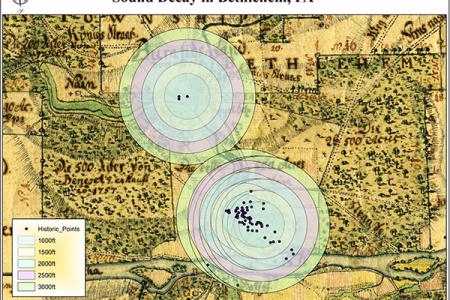
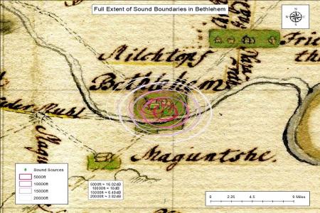
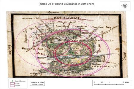
The maps were produced using decibel level readings and field recordings collected in Bethlehem and the nearby Moravian farm, Burnside Plantation. These sound sources were then processed using a rasterized historical map of Bethlehem which included detailed information on the surrounding terrain and tree cover. The rasterized map was then combined with a SPreAD model designed to study noise pollution in order to create distinct cells, or pixels, representing particular types of topography: barren land, coniferous and deciduous forest, grass and shrub land, urban development, and water. The SPreAD model used for this study permits an analysis of distance decay in past sound sources that acknowledges the interaction of sound waves with terrain, rather than the idealized Euclidian model of distance decay based on spreading concentric circles. The sound decay maps on this page use circles and other shapes to display the extent of sound extending outward from a point, measured in decibel levels. The maps have been rasterized into 100-foot cells and assigned a category based on the SPreAD model of distance decay.
Interactive Sound Boundary Map
Use the map's legend to explore various distances and their effect on the acoustic boundaries of the Bethlehem community.