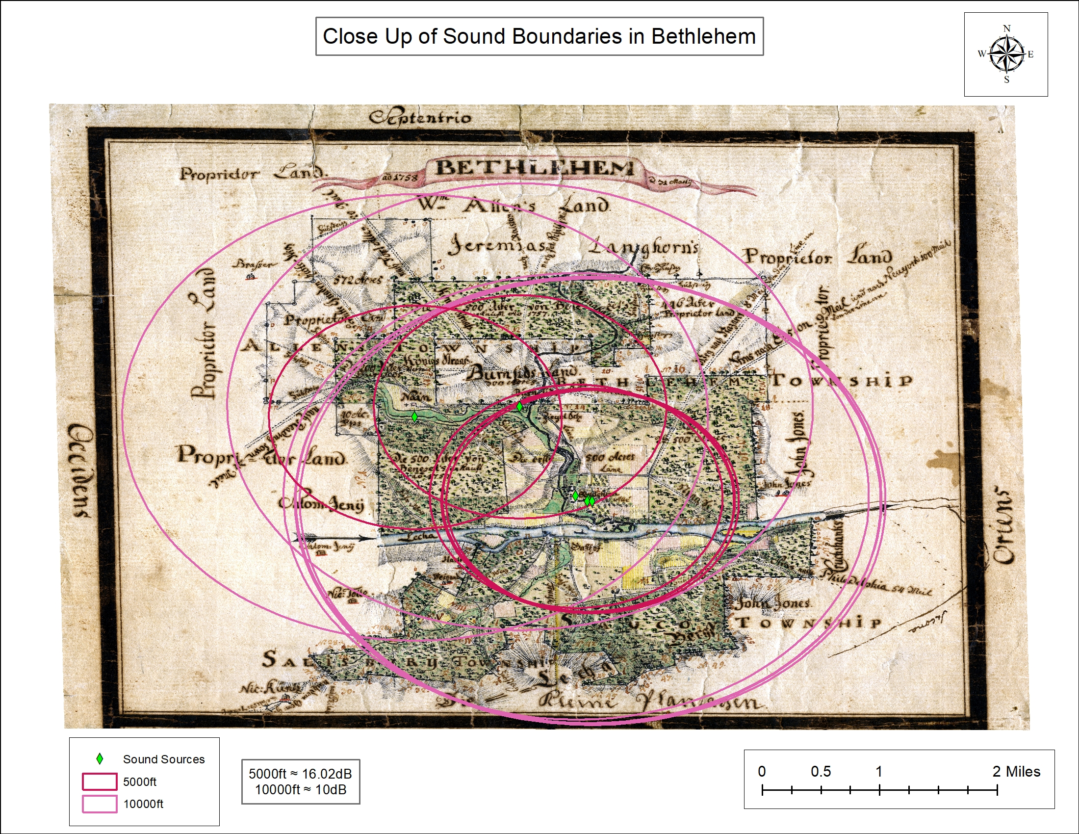
This map is a second version of the “Full extent of sound boundaries” map. It offers a close-up extent of the sound boundaries over a different basemap, Philipp Christian Gottlieb Reuter's “Topographic Map of Bethlehem, Pennsylvania and Surrounding Tracts (March 31, 1759).” This Reuter basemap was a significant aid to creating the sound boundary maps, because it detailed the different types of tree and landcover present in the Bethlehem area in 1759. This data was especially useful in working with the SPreAD model, since the formula was capable of taking into account different types of barriers that would effect sound decay in the Bethlehem community. As sound travels through space, tree cover, open fields, rivers, creeks, and buildings all play a role in how sound spreads through a community. Using the Reuter basemap, the Moravian Soundscapes team was able to determine how sound would have traversed the Bethlehem landscape through distance decay analyses in the SPreAD model. This simplified version of the interactive SPreAD map shows the extent of sound at 5,000ft and 10,000ft when the decibel levels are measured at 10dB, well below a human whisper and therefore below a level distinguishable by the human ear as the sound approached 0dB, the threshold of human hearing. Again, as with the other sound boundary maps, the maps make visible the sonic experiences of Bethlehem's residents, manifesting visually the political, social, religious, and cosmological acoustic boundaries of the community.