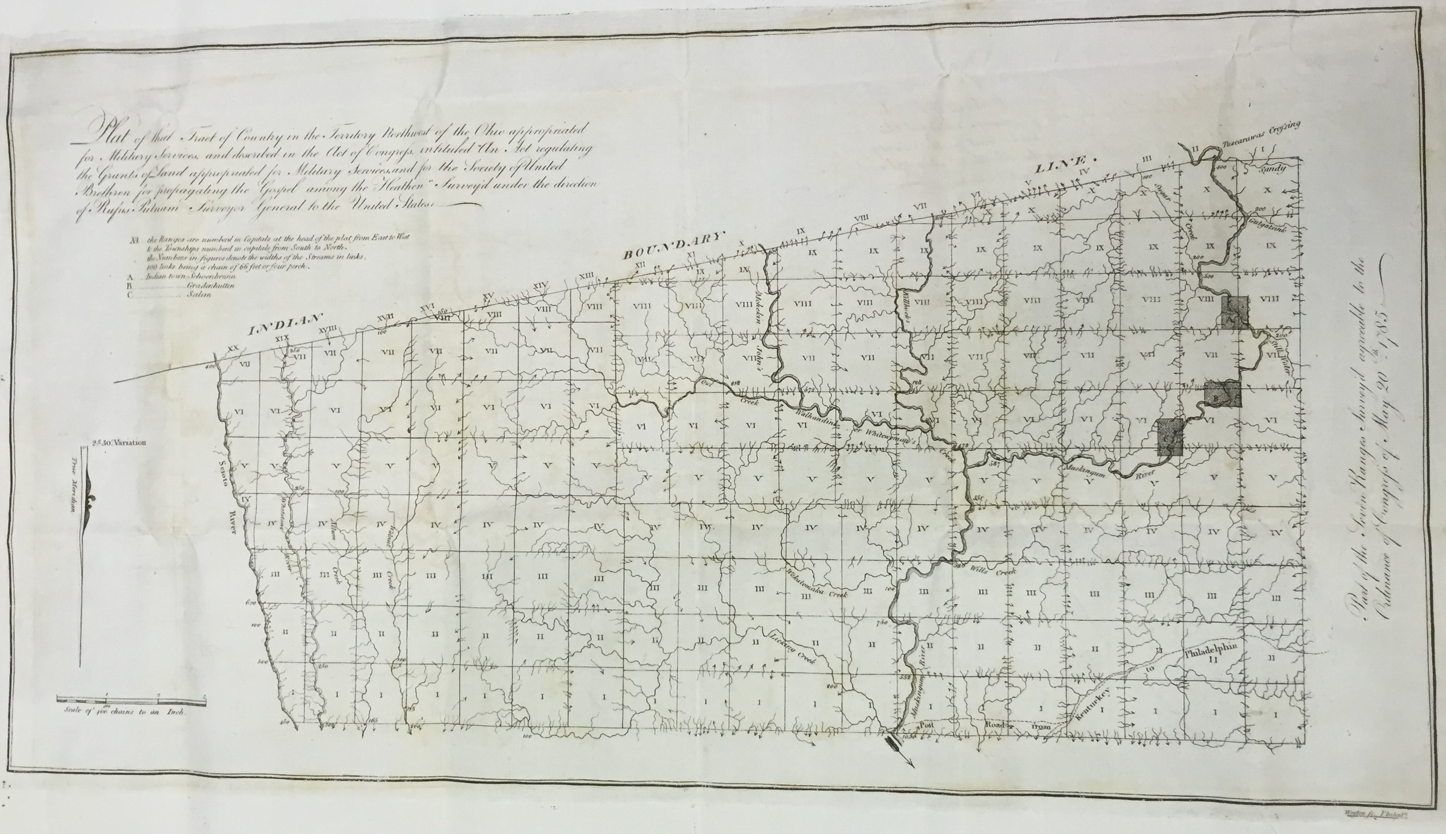
Map of the Old Northwest Territory created under the direction of Rufus Putnam, Surveyor General of the United States, showing land gifted by the United States Congress to the Moravian Church in 1785. The three tracts of land along the Muskingum River that had been the sites of the former Moravian missions of Gnadenhütten, Schoenbrunn, and Salem are shaded in dark gray on the map. DP f.226.01. Moravian Archives, Bethlehem.